


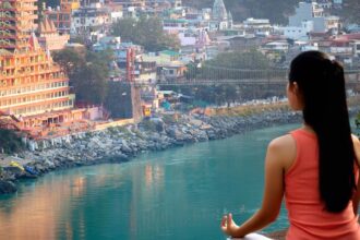

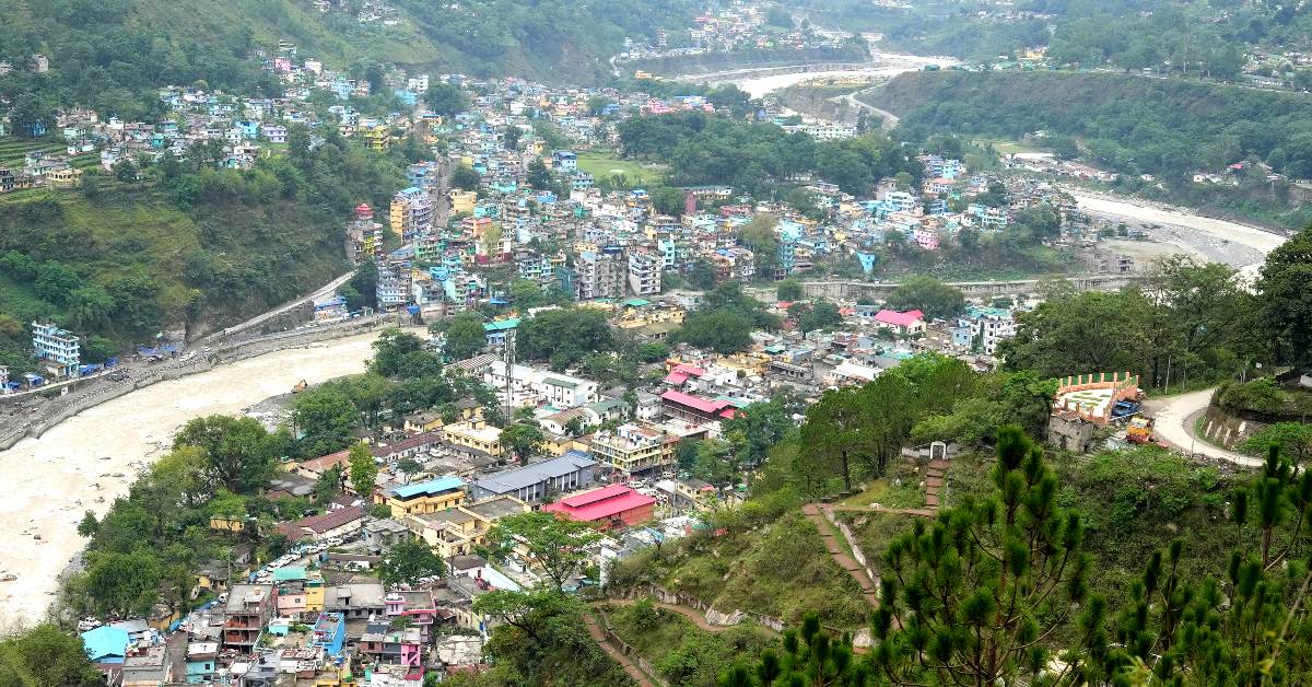
Dharchula, located in the Pithoragarh district of Uttarakhand, India, is a town nestled at an altitude of 940 meters above sea level. This picturesque town is encircled by towering peaks on all sides and is bisected by the Kali River, creating two distinct areas on either bank—one in India and the other in Nepal. The Kali River, originating from Kalapani, also serves as the natural boundary between India and Nepal. The residents of these twin towns share similar traditions, cultures, and lifestyles, enjoying the privilege of crossing the border without requiring passports or visas. The region boasts a blend of Kumaouni and Rung languages, traditions, and cultures, fostering seamless movement between the two nations.
Dharchula is situated approximately 92 kilometers north of Pithoragarh town and is a significant stopover on the Kailash-Mansarovar pilgrimage route. It lies along the Pithoragagh-Lipulekh Pass Highway (PLPH).
The name “Dharchula” is derived from two words: “Darchyo,” which refers to the white-colored traditional holy flag displayed outside local community houses, and “la,” an honorific term in the Runglwo language. The town is nestled in a valley along the banks of the Kali River, and its name reflects the prominent visibility of these white flags from afar.
Demographics: As of the 2011 census, Dharchula Nagar Palika (municipality) had a population of 7,039, with 3,797 males and 3,242 females. The female-to-male sex ratio in the town was 854, slightly lower than the state average of 963. Children aged 0–6 accounted for 12.64% of the population, with a child sex ratio of 824 compared to the Uttarakhand state average of 890. Dharchula boasts a high literacy rate of 88.68%, surpassing the state average of 78.82%. Male literacy stands at around 95.10%, while female literacy is at 81.20%. The primary religion practiced in Dharchula is Hinduism (91.45%), followed by Islam (7.61%), Christianity (0.67%), and Sikhism (0.17%).
Culture and Language: The predominant language spoken in Dharchula is RungLo, a local language that continues to thrive despite lacking a written script. Alongside RungLo, residents are proficient in Hindi, Nepali, and English, especially among the younger generation. The Rung community in Dharchula celebrates festivals and important occasions with enthusiasm, featuring dance, songs (baira), and locally prepared wine (sathani).
Traditional attire, known as Chungbala and Ranga, is reserved for special occasions, with men donning Byanthalo (turbans). Women adorn themselves with big silver necklaces, nose rings, and earrings. In recent times, fashion trends have evolved, with residents wearing everything from Ghagras to Lehngas and traditional attire to modern jeans, reflecting the town’s growing commercialization.
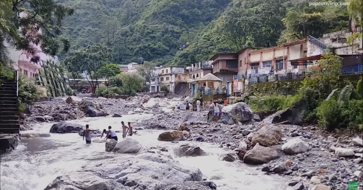
Geography and Climate: Dharchula is nestled in a valley at an elevation of 940 meters, approximately 92 kilometers from its district headquarters, Pithoragarh. The journey from Pithoragarh to Dharchula follows the scenic Kali River and typically takes 3 to 4 hours. The road conditions are generally good, with various eateries along the way. However, landslides during the rainy season (July–September) can make travel challenging.
The town enjoys warm and sunny summers, but winters are cold, with snowfall in the higher altitudes. Dharchula’s location provides breathtaking views of snow-capped peaks in the surrounding area.
History: Dharchula has a rich history as an ancient trading town on the Trans-Himalayan trade routes. Trade, primarily based on the barter system, was the primary source of income for its inhabitants. Local handicrafts like carpets, known as ‘dan,’ were exchanged with Tibetans for food and clothing. However, the Indo-China War in 1962 disrupted all trading ties with Tibet, forcing the people of Dharchula to explore alternative means of livelihood. Farming, small businesses, and cattle farming became essential sources of income. Government intervention has since led to the development of tourism facilities in the town.
Flora and Fauna: Dharchula’s favorable climatic conditions and limited human interference have allowed lush vegetation to flourish. Oak, pine, apple, and deodar trees grace the landscape, although increasing global warming has affected fruit production. The region is home to various wildlife species, including leopards, bears, foxes, monkeys, and deer, along with domestic animals like horses, mules, and sheep.
Military Presence: Dharchula houses a permanent military station of the Indian Army, known as “The Kumaon Scouts,” which is a scout battalion of the Kumaon Regiment. This strategic location near the borders of India, Tibet, and Nepal makes it an important military station.
Important Landmarks and Destinations:
- Dharchula Gumba: A holy pilgrimage site for both Hindus and Buddhists, this Buddhist Cave Temple dates back to the 8th century. It features mantras and holy symbols carved on its walls and holds spiritual significance for those embarking on the Kailash Mansarovar Yatra.
- Narayan Ashram: Situated at an elevation of 2734 meters above sea level, this ashram was established by Sri Narayan Swami in 1936. It can accommodate up to 40 people and serves as a place of retreat and spiritual reflection.
- Kailash Mansarovar: A place of pilgrimage, this sacred lake is believed to cleanse sins, and pilgrims come to take ceremonial baths in its cleansing waters. The lake is also the source of several important rivers.
- Kali River: Originating from the Greater Himalayas, the Kali River forms India’s eastern boundary with Nepal on its upper course.
- Dhauliganga Dam: Located 20 km from Dharchula, this dam on the Kali River has a capacity of producing 280 MW of power.
- Om Parvat and Adi Kailash: Adi Kailash, often referred to as Little Kailash, is an ancient holy Hindu mountain with a distinct resemblance to Mount Kailash in Tibet. The Om Parvat, nearby, has a snow deposition pattern that resembles the sacred syllable “AUM.” These sites hold great spiritual significance for Hindus.
- India-Nepal and India-Tibet Border: Dharchula shares its borders with both Nepal and China and serves as a peaceful example of intercultural harmony between the nations.
